
Welcome
General Policies
General Info
Troubleshooting
Tips and Tricks
Provisioning Guides
Firmware Updates
FAQ's
HH Staff Documents
(1) Login Account Required
(1) Login Account Required
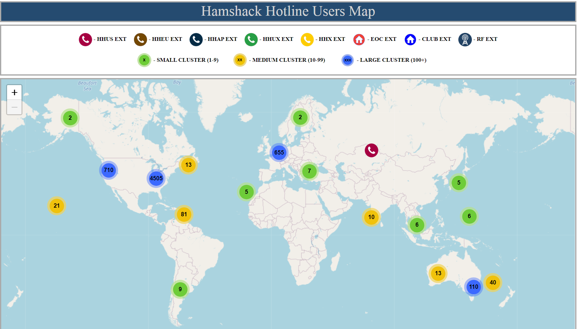
In late April of 2022, Bill Lewis, KG6BAJ, took up a project to redesign the HH map to be more user friendly. Bill took the original data supplied by the v1.0 map creator and created a new map that had the following features.
1 - Data stored in a Hamshack Hotline server database.
2 - Map was switched from Google to OpenSteetMaps.
3 - Map now contains “Clusters” of users when first loaded. This dramatically improved load times.
4 - When hovering your mouse over a cluster, a blue polygon shaped image forms. The shape that forms is the specific geographic region that encompasses all the individual pins for that cluster.
So, for example, when you first load the map, on the west coast of the U.S., you will see a blue cluster that says “705”, and when you hold your mouse over it, you will see a blue region that stretches over the western third of the U.S. and reaches up into the western, lower half of Canada.
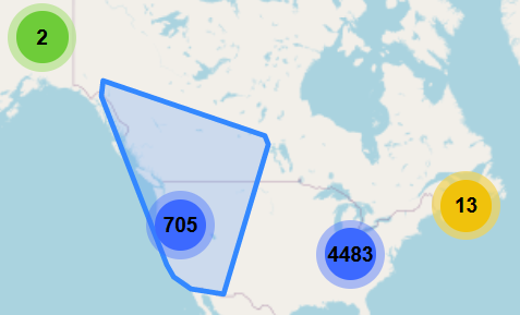
That is the geographic area of where all 705 individual pins reside.
(Note: The 705 number is at time of posting this wiki. Number will grow over time).
As you click a cluster, you get drawn in closer on the map. The big cluster you clicked on, will then break down into several smaller clusters with smaller numbers.
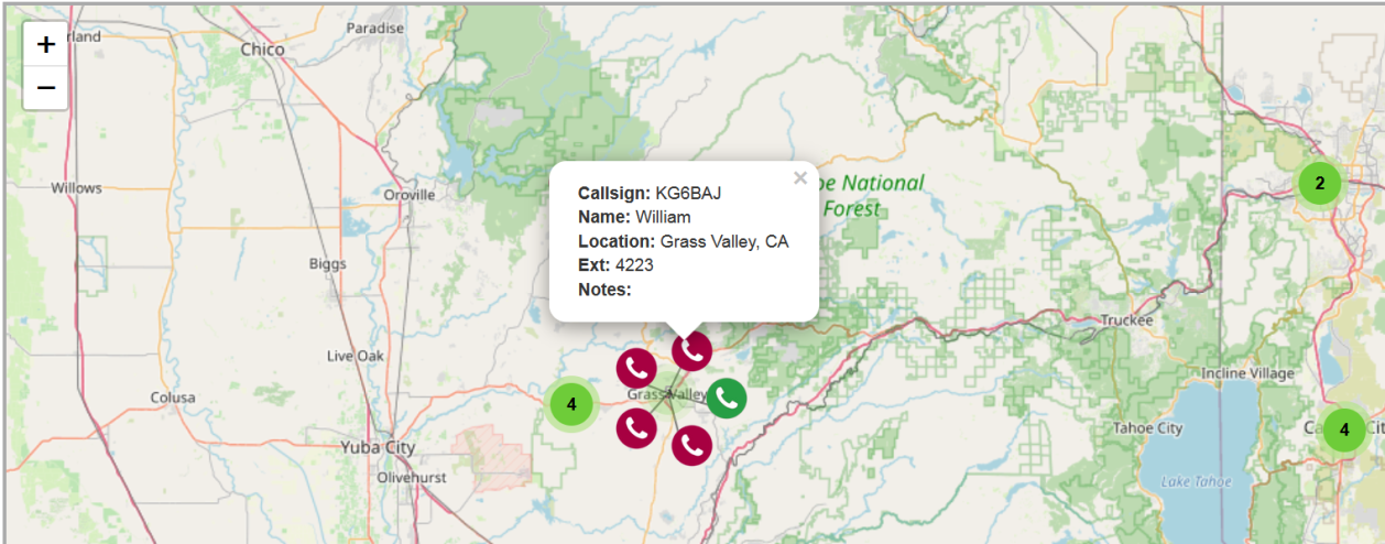
You keep clicking on clusters and keep drilling in closer on the map until you finally reach a single cluster that, when clicked, spreads out with individual colored markers for each user at those LAT/LON coordinates.
When you then click any individual colored phone marker it will display the information about that user.
And with that, we at Hamshack Hotline hope you enjoy the new map.
The Hamshack Hotline Map, version 1, had been implemented March of 2018 using a free Google map with pin drops.
But, the original map had issues.
1. It was a free Google map with limitations.
2. data set is getting quite large.
HHUS 4000-5999 - 1944 entries
HHUS II 11xxx- - 969
HHUS III - 12xxx - 734
HHEU 24xxx - 270
HHAP 30xxx - 92
HHUX 50xxx - 355
(numbers as of the date this wiki was made)
3. It's very difficult to move entries between datasets, at least manually.
4. Overlapping Icons - We don't use exact locations on the map, unless you specifically direct us to. The problem arises when you have a bunch of stations in the same place. The icons stack up on each other, obscuring any icons underneath.
5. As a public viewer of the map you were not allowed by the Google map system to 'Drag' the top icon out of the way so you could see icons directly beneath.